Ahjumawi Lava Springs State Park has many miles of hiking trails, fascinating human history, and an abundance of wildlife, fascinating volcanic geology, and Cascade volcano views. You’ll have to boat to the park, but that adds to the adventure and also means you’ll have less company.

These three hike descriptions of Ahjumawi Lava Springs State Park hiking trails, and the accompanying Ahjumawi Lava Springs State Park hiking trails map, are from one of my older books: 75 Hikes in California’s Mount Shasta and Lassen Volcanic National Park Regions. I’ve kept the hike numbers here to make it easier to see how the different trails relate to each other, and to make it easier to follow them on the map. The Fish Hawk Trail on the map is now called the Osprey Trail. Note the some of the trails are now overgrown in places.
Best Day Hiking Trails in Upper California
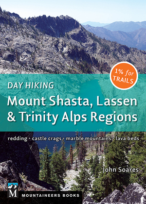
 My compact guidebook has the 125 best day hikes:
- Mount Shasta and nearby
- Lassen Volcanic National Park
- Trinity Alps and Marble Mountains
- Redding area
- Whiskeytown and Shasta Lakes
Includes trailhead directions and detailed maps and trail descriptions
Buy it: on Amazon | on Bookshop.org
Often available at bookstores and outdoor stores (call first!)
Rat Farm Trailhead Driving Directions: Ahjumawi Lava Springs State Park
Take CA Highway 299 to McArthur in the Fall River Valley. Take Main Street north past the fairgrounds to a dirt road. At 0.5 mile, go right and pass through a gate. The good gravel road continues north another 3.0 miles to the parking area at Rat Farm. GPS coordinates: N 41 06.002 W 121 24.729. Pit toilet at parking area. Note: Rat Farm is also the trailhead for hiking the levee trails of Big Lake, Horr Pond, and the Tule River.
Access to Ahjumawi Lava Springs State Park…
is by boat only!
Ready your kayak, canoe, or other watercraft and head north out the narrow channel (be sure to follow all proper precautions for safe water travel). Once beyond the channel, travel a mile northwest toward Mount Shasta, then reach Ahjumawi Lava Springs State Park at the Horr Pond camping area (look for trash cans near the shore). Motorboats must bypass Horr Pond and travel to the deeper landing area at Crystal Springs another mile west.

When to Visit Ahjumawi Lava Springs State Park
You can visit Ahjumawi Lava Springs State Park year-round as weather conditions permit (occasional winter snow); hunting season runs from early October to mid-January. I prefer to day hike or backpack in spring.
Camping at Ahjumawi Lava Springs State Park
You can camp in any of the three designated areas with campsites Ahjumawi Lava Springs State Park: Horr Pond, Ja She Creek, and Crystal Springs. First come, first served, and use the pay envelopes at the sites.
Questions About Ahjumawi Lava Springs State Park?
Visit the park website and/or contact McArthur-Burney Falls Memorial State Park at 530-335-2777.

46 Crystal Springs and Ja She Creek Trail
Length: 5.4 miles round trip
Hiking time: 3 hours
High point: 3,325 feet
Total elevation gain: 100 feet
Difficulty: easy
Map: USGS 7.5′ Fall River Mills
This journey features a full complement of the natural and human history of Ahjumawi Lava Springs State Park: The southern horizon holds Lassen Volcanic National Park peaks and other nearby mountains; Horr Pond hosts a plethora of water birds, including Canada geese, mallards, teals, pelicans, great blue herons, and ospreys; water from 50 miles north seeps underground through porous volcanic rock to emerge at Crystal Springs; Crystal Springs is also the site of rock fish traps used by the Ahjumawi Indians; and at the hike’s far point is an old farm.
Start the hike by heading west from the Horr Pond campsites on the Lava Springs Trail. Near the water, a variety of birds go about the daily activities of their lives; year-round residents include Canada geese, great blue herons, mallards, osprey, and cinnamon teals. Beyond the stretch of shallow water, you’ll spy Prospect and West Prospect peaks, Lassen Peak, Chaos Crags, and the thin-air summits in Thousand Lakes Wilderness.
Note a small spring seeping from the porous volcanic rock at the water’s edge just before you reach a trail fork at 0.6 mile. Bear left and then spy a small, marshy pond on the right. Pass lava boulder fields and western juniper trees, then note a large ponderosa pine that splits into three trunks.
Crystal Springs Campsites
You’ll soon reach the first of three environmental campsites at Crystal Springs and then Crystal Springs itself at 1.2 miles. From this placid place of beauty, you can see the water flowing under oak branches into lower Ja She Creek. The Ahjumawi Indians built the rock fish traps surrounding the springs; Lat he—Sacramento sucker fish—come here to spawn in the spring, when the Ahjumawi would close off the route back to Ja She Creek with rocks to catch the fish. A signboard provides more details about the Ahjumawi; another displays a map of the park. The area also has a dilapidated old trapper’s cabin that could serve as a shelter in an emergency.
Best Day Hiking Trails in Upper California
 My compact guidebook has the 125 best day hikes:
- Mount Shasta and nearby
- Lassen Volcanic National Park
- Trinity Alps and Marble Mountains
- Redding area
- Whiskeytown and Shasta Lakes
Includes trailhead directions and detailed maps and trail descriptions
Buy it: on Amazon | on Bookshop.org
Often available at bookstores and outdoor stores (call first!)
Ja She Creek
The path then wanders away from the shoreline to travel past lava flows, eventually reaching and crossing upper Ja She Creek at 1.7 miles. From the bridge spanning the stream, you can peer into the clear waters; if you desire a swim, try the waist-high water on the downstream, eastern side of the bridge. Another signboard describes the natural history of Ja She Creek.
The route soon leaves the water behind and travels through open country past three more campsites. Fields and large barns in the distance give picturesque testimony of the Fall River Valley’s agricultural economy.
Enter ponderosa pine forest at 2.2 miles. More meadows follow, with a large one stretching north to an old homestead site. From here, you’ll also have the first full view of distant Mount Shasta. The path eventually bridges a small brook, then ends at another abandoned farm—a two-story farmhouse surrounded by an old barn and several outbuildings.

47 Spatter Cone Loop Trail
Length: 4.3-mile semi-loop
Hiking time: 3 hours
High point: 3,470 feet
Total elevation gain: 250 feet
Difficulty: easy to moderate
Maps: USGS 7.5′ Fall River Mills, USGS 7.5′ Timbered Crater
Volcanoes and volcanic activity highlight this Ahjumawi Lava Springs State Park hike: In the distance, majestic Mount Shasta rises high to the northwest, and Lassen Peak and nearby monster summits dominate the skyline to the south; up close, you can enter a lava tube cave and clamber along the rim of a spatter cone. Most of the terrain along the route is open and bordered by hills of basaltic rock deposited in chaotic jumbles. Stark and beautiful but not the most hospitable during the heat: Do this one on a cool day or in the morning.
From the campsites at Horr Pond, briefly head west near the shore on the Lava Springs Trail. Bear right onto the Spatter Cone Loop Trail and walk north, initially through a sparse forest of western juniper, ponderosa pine, and white and black oak. Soon you enter the surreal realm of lava land, where the bare, black basalt forms a brooding landscape. You, however, have the relatively smooth trail to guide you comfortably on.
You’ll soon obtain the first tree-filtered view of Mount Shasta. As you continue up, stop occasionally to take in the southern view gained during your earlier wandering near the water. At .8 mile the Osprey Trail appears on the right. Stay left, and then stay right 100 yards farther at another trail junction.
Spatter Cone
Reach the spatter cone at 1.9 miles. Climb the rim to gain the full view of the spatter cone, which measures 100 feet across and 20 feet deep. Spatter cones form when volcanic vents shoot fountains of gaseous lava skyward; the hot lava falls around the vent to flatten on impact, thus forming plate-like layers of thin and brittle rock that can make for tricky walking.
Lava Tube Cave
From the spatter cone, begin a long and gentle southern descent featuring a panorama of Lassen Peak and the first full view of Mount Shasta. Continue one mile downhill until you come to a small cave, the remnant of a lava tube created thousands of years ago. Lava tubes form from flows of liquid basalt. The lava near the surface of the flow cools first, while the hotter and more fluid liquid lava below streams out from underneath, leaving a hollow tube behind. The cave, about 15 feet wide, 30 feet deep, and up to 6 feet high, provides a cool respite when it is hot above. You won’t need a light to explore it, but be careful: The floor is uneven and you can easily bump your head.
Camp for Free in California National Forests
 California’s national forests and BLM lands have thousands of miles of dirt roads with lots of spots for dispersed camping (boondocking). My book provides all the info you need to get started (but is not a guide to specific sites):
- Researching the best locations
- Finding the best camping spots
- Backcountry safety and ethics
- What to take
Buy it on Amazon
Buy it on Apple, Kobo, and Nook
Reach the connector trail to the other side of the loop at 3.3 miles. Go left, continue another .2 mile, then bear right at the trail fork. Quickly reach another fork and go right again (a left takes you 1.0 mile on the Osprey Trail to hike 48’s Juniper Trail). From here, it’s an easy 0.8 mile back to the hike’s beginning at the Horr Pond campsites on the trail you hiked up earlier.
48 Big Lake Springs Trail
Length: 5.4 miles round trip
Hiking time: 3 hours
High point: 3,425 feet
Total elevation gain: 200 feet
Difficulty: easy
Maps: USGS 7.5′ Fall River Mills, USGS 7.5′ Timbered Crater

The hike through Ahjumawi Lava Springs State Park to Big Lake Springs travels a 3-mile stretch along the shores of Horr Pond and Big Lake, allowing you to observe geese, ducks, herons, and a large variety of other waterbirds and also to have unimpeded southward views of valley and mountain that stretch all the way to Lassen Volcanic National Park.
From the Horr Pond campsites, head easterly along the shore of Horr Pond on Lava Springs Trail and enjoy panoramic views of Prospect Peak, West Prospect Peak, Lassen Peak, and Chaos Crags in Lassen Volcanic National Park, Thousand Lakes Wilderness mountains, Burney Mountain, and Soldier Mountain. Directly to the east, Big Valley Mountain rises steeply above the Fall River Valley. Its western edge marks the boundary of a fault, along which Big Valley Mountain rose over the eons as Fall River Valley dropped, a geological pattern that marks much of the terrain of northeastern California, southeastern California, western Utah, and Nevada.
At 1.0 mile, the trail ascends a small rise at the east end of Horr Pond to reveal a sweeping vista of Big Lake. It then turns north along the lake.
Western juniper, occasional groves of black and Oregon white oak, and willows provide pleasant company as you continue. Reach a small cove at 1.4 miles that’s a favorite sunning spot for turtles, then walk briefly uphill to see a large conic depression that holds a small pond.
Go straight at a trail fork at 1.9 miles, then note the several large ponderosa pines that grace the route. Continue past chunky lava flows and more ponderosa pines as you alternate between the shore of Big Lake and its hilly, bordering terrain.
Big Lake Springs
Pass through a small, open thicket at 2.9 miles to reach Big Lake Springs. Here you can sit in the green grass and watch the spring’s small flow merge with the vast stillness of Big Lake. The water originates as rain and snow melt in the vicinity of Tule Lake 50 miles north; it slowly percolates through porous basalt lava to form this spring and most, if not all, of the other springs in the Fall River Valley, including the springs that form Fall River itself.
When you’re tanned, rested, and ready, leave Big Lake Springs and head back the way you came, 1.0 mile to a trail fork, where you head right on the Juniper Trail. Climb through mixed forest, stay right on the wide main path at an unmarked junction 0.8 mile farther, then note a second conic depression on the right that looks like a large meteor crater. Continue 0.2 mile to a trail fork (watch closely for the trail before and after). The Fish Hawk Trail goes right for 1.0 mile to meet the Spatter Cone Loop Trail and hike 47. You go left for a half-mile ramble to the Horr Pond campsites and the hike’s end.
Want More Nearby Hikes?
 See my book Day Hiking: Mount Shasta, Lassen & Trinity Alps Regions has dozens of trails to the south, west, and north, including Lassen Volcanic National Park and Lava Beds National Monument.
And there’s also the Big Lake, Horr Pond, and Tule River levee trails that leave from Rat Farm, the same parking area/trailhead for Ahjumawi Lava Springs State Park.
Your Take: Ahjumawi Lava Springs State Park Hiking Trails
Questions or comments? Speak up below…


Leave a Reply