The Clikapudi Trail offers vistas of the mountains surrounding Shasta Lake, opportunities to explore the the lake’s Pit River arm, and the tranquil beauty of Clikapudi Creek and its valley.

Ghosts from a time long past share the Clikapudi Trail with hikers. The Wintu Indians lived in and around the area circumscribed by the trail, and fenced-off archaeological sites and flat clearings whisper of more tranquil days along Clikapudi Creek, before the white man’s arrival.
Clikapudi Trail Burned by the Jones Fire and Bear Fire
Two devastating fires burned through this area of Shasta Lake, including much of the terrain encompassed by the Clikapudi Trail. The Jones Fire swept through in 1999, followed by the Bear Fire in 2004. You’ll definitely see some evidence of the wildfires, but the landscape is recovering well and there is much beauty for you to enjoy.
Clikapudi Trail Key Data

Distance: 7.6-mile loop
Difficulty: Moderate
Type: Day hike
Elevation gain: 750 feet
High point: 1394 feet
Season: year-round; hike in the morning on hot summer days
Information: Shasta Lake Ranger Station, Shasta Lake National Recreation Area, Shasta-Trinity National Forest; 530-275-1587; info here
Maps: USGS Bella Vista
Permits: no permit needed
Clikapudi Trailhead GPS coordinates: N 40 44.321 W 122 12.919
Notes: dogs allowed; toilet at trailhead at the Jones Valley Boat Ramp; popular with mountain bikers
Clikapudi Trailhead at Jones Valley Boat Ramp
There are two ways to reach the main trailhead for Clikapudi Trail at the Jones Valley Boat Ramp. The first: take the Mountain Gate exit off I-5 north of Redding, drive east and south on Old Oregon Trail about 4 miles, then turn left onto Bear Mountain Road. Follow this road about 6 miles, then go right at the “Y” onto Jones Valley Road, which ends 2 miles farther at the Jones Valley Boat Ramp. The trailhead is located just behind the large sign as you enter the Jones Valley Boat Ramp parking lot. The second: take Highway 299 east from I-5 about 6 miles to the town of Bella Vista, then turn left (north) onto Dry Creek Road. This road meets Bear Mountain Road 4 miles later, just before Jones Valley Road.

Hiking the Clikapudi Trail
The Clikapudi Trail begins in an unusually large knobcone pine forest, which stretches southwest all the way to the lower Jones Valley Campground. But it quickly abandons these strange trees with their tightly attached cones for more common ponderosa pines, interior live oaks, and whiteleaf manzanita.
Best Day Hiking Trails in Upper California
 My compact guidebook has the 125 best day hikes:
- Mount Shasta and nearby
- Lassen Volcanic National Park
- Trinity Alps and Marble Mountains
- Redding area
- Whiskeytown and Shasta Lakes
Includes trailhead directions and detailed maps and trail descriptions
Buy it: on Amazon | on Bookshop.org
Often available at bookstores and outdoor stores (call first!)
Advanced Loop: Hikers and Mountain Bikers
Climb gently for 0.6 mile to a saddle just west of Buck Point. Leave the main Clikapudi Trail and go left to climb the 1.0 mile Advanced Loop that’s very popular with mountain bikers. From the top you’ll get the best views of the journey, with much of Shasta Lake and its surrounding mountains unfolding before you.
Shasta Lake Pit River Arm
Back at the saddle beside Buck Point, drop north down to the lake’s high-water line. At this point, 2.0 miles from the trailhead, the Pit River arm opens up to full view. When the lake is low you’ll see the bleached corpses of trees sticking straight out of the water. Most vegetation below shoreline was removed before the dam was completed, but America’s 1941 entry into World War II meant manpower could not be spared to clear trees on the upper stretches of the Pit River. Today these denuded snags provide valuable habitat for bass and other fish.
The trail undulates along the Pit River arm for another 0.5 mile, then turns southwest to follow Clikapudi Bay. Over the next mile the path passes a picnic area, over a small wooden bridge, through a thick grove of Douglas fir, and then turns west to follow the part of Clikapudi Creek not captured by the lake.
Wintu Indian Sites
After a 0.5-mile walk through the creek’s flat valley, you’ll see an area on the right surrounded by a high barbed-wire fence. It’s the first protected Wintu site; the second fenced site is 0.25 mile farther along. No obvious physical evidence manifests the past activities of the Wintu, so you’ll have to use your imagination.
Back to Jones Valley Boat Ramp
The trail continues along Clikapudi Creek and then climbs northwest out of the valley. From the saddle above Jones Valley Road, 0.5 mile from the second Wintu site, switch back down to the pavement, cross the road, and head right 50 yards to the continuation of the Clikapudi Trail. The path continues its descent another 0.2 mile to a trail fork. The left (west) trail ends after 1.0 mile at the Jones Valley Campground. The main trail continues right (east) through the knobcone pine forest for 1.3 miles back to the trailhead.
More Shasta Lake Hiking Trails
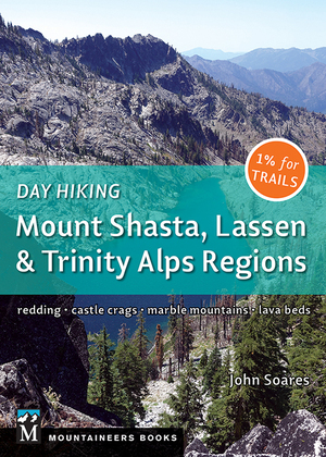
 My guidebook Day Hiking: Mount Shasta, Lassen & Trinity Alps Regions has 125 hikes, including four trails/trail systems in Shasta Lake National Recreation Area:
- Dry Creek Trail from Shasta Dam
- Waters Gulch Trails (including Overlook Trail, Fish Loop Trail, and Eastside Trail)
- Bailey Cove Trail
- Hirz Bay Trail
The book also covers 15 hikes in and near Redding, 11 hikes in Whiskeytown National Recreation Area, and six hikes in Castle Crags State Park.
And see my Sugarloaf Creek Trail post and Potem Falls Trail post, which both have swimming opportunities in the Shasta Lake area. Also see my post about Shasta Lake’s human and natural history.
Your Take on the Clikapudi Trail
Share your thoughts below…
Camp for Free in California National Forests
 California’s national forests and BLM lands have thousands of miles of dirt roads with lots of spots for dispersed camping (boondocking). My book provides all the info you need to get started (but is not a guide to specific sites):
- Researching the best locations
- Finding the best camping spots
- Backcountry safety and ethics
- What to take
Buy it on Amazon
Buy it on Apple, Kobo, and Nook


Leave a Reply