Backpackers and day hikers need to know the conditions of Trinity Alps Wilderness trails and trailhead access roads before they begin their explorations of this beautiful and remote region in Northern California. I discuss the main source for trail and road information below in this 2025 update.
2025: Lots of Snow in the Trinity Alps!
Fortunately for decreasing wildfire danger, the winter of 2024-2025 has seen above normal snowfall for California’s mountains, including the Trinity Alps. This means that many of the most popular backpacking and day-hiking trails in the Trinity Alps will likely have substantial snow into August. Plan accordingly!
Get the most up-to-date info on the Trinity Alps Wilderness Pictures & Information Facebook group.
Trinity Alps Wilderness Trails Affected by 2021 Wildfires
Many hiking trails in the Trinity Alps Wilderness pass through areas affected by 2021 wildfires, including the River Complex Fire. For details of specific trails, contact the Weaverville Ranger Station at 530-623-2121 for Trinity Alps Wilderness trails on Shasta-Trinity National Forest, and the Salmon/Scott River Ranger District at 530-643-1838 for Trinity Alps Wilderness trails on Klamath National Forest. See more details of closed trails covered by my Northern California hiking guidebooks. and see my 2022 trip report about the Trail Gulch Lake/Long Gulch Lake loop.
—————————————-/
I get a lot of emails and blog comments from backpackers and day hikers asking me about the conditions of specific trails in the Trinity Alps Wilderness. I answer when I know and when I have the time, but there are over 550 miles of trails in over 500,000 acres: There’s no way I can know everything about the Alps, and I’m not the best source for current conditions.

Explore the Wild and Rugged Trinity Alps With This New Map!

The alpine lakes and jagged peaks of the Trinity Alps Wilderness rival the scenery of the High Sierra, without the crowds. This new highly detailed map is perfect for your next backpacking trip or day hike:
- Canyon Creek Lakes, Caribou Lake, and all the main destinations
- Trails with more solitude in more remote parts of the wilderness
- Obtaining a wilderness permit
- Boundaries of recent wildfires
Buy it online from: Green Trails Maps | Amazon
Often available at outdoor stores and bookstores (call first!)
2025 Trinity Alps Trail Conditions Update
The highly detailed Trinity Alps Wilderness Trail Condition Report that had long been updated weekly during the hiking season is permanently gone. It had been run by Jim Holmes of the Shasta-Trinity National Forest, but he retired.
Fortunately, there’s another way to get Trinity Alps trail conditions:
Join the Trinity Alps Wilderness Pictures & Information Facebook group. It’s growing rapidly and often has good recent intel.
Until recently there was a trail conditions report from the Weaverville Ranger Station that came out infrequently during the summer months. Sadly, it is also gone. There are not enough funds for employees to gather the required information. (The more general Shasta-Trinity National Forest page with links to forest recreation reports is here.)
The Weaverville Ranger Station also no longer provides a recording about Trinity Alps trail conditions on their main phone number. Do feel free to call and ask with more general questions: at 530-623-2121, and then press 0 for the operator.
How to Get Snow-Depth Estimates for Trinity Alps Trails
The US Forest Service has a snow-depth map for the Trinity Alps — and anywhere else in the United States.
If you have a premium subscription to Gaia GPS or to Caltopo, you can choose snow-depth layers for the Trinity Alps (or anywhere else).
Camp for Free in California National Forests
 California’s national forests and BLM lands have thousands of miles of dirt roads with lots of spots for dispersed camping (boondocking). My book provides all the info you need to get started (but is not a guide to specific sites):
- Researching the best locations
- Finding the best camping spots
- Backcountry safety and ethics
- What to take
Buy it on Amazon
Buy it on Apple, Kobo, and Nook
So Why Do Trail Conditions Change?
Trail conditions can change for several reasons.
Snow is often the biggest factor.
If the path disappears under a foot of snow, you’re going to have a difficult time following it. Of course, snow levels vary with the total amount of snow that fell over the winter, the time of season you want to hike, the elevation you’ll be hiking at, and geographical factors such as the tendency of snow to linger on the north sides of slopes.
Fallen trees.
Winter storms and strong summer thunderstorms knock down trees. Usually, hikers and backpackers can scramble over or around fallen trees, but if there are fifty of them across your route, you might wish you’d chosen another itinerary.
Wildfires.
Wildfires are a common reason for trail closures. I have a detailed post about how to find out about current California wildfires and smoke conditions. And also make sure you don’t start a fire yourself; make sure you get a California campfire permit before your backpacking trip. (And see this post what to do to survive a wildfire)
Erosion.
Heavy rains can create big gullies in trails and in access roads.
Mass movements of rock and earth.
Occasionally heavy rains can cause hillsides to give away and slide or slump across trails and roads. In addition, rocks large and small fall from heights.
Also Pay Attention to Trailhead Access
The same factors just mentioned also affect driving to the trailhead. Make sure you can get to the trailhead and that the route is suitable for your vehicle. Road maintenance can be particularly expensive, and erosion can turn what was once a road accessible to passenger cars with moderate clearance into a road accessible only to SUVs and trucks with high clearance.
So Why Doesn’t the USFS Maintain All the Trails and Roads?
Three words: lack of money. As a hiking guidebook author, I have frequent contact with people like Jim Holmes who manage the trail systems on our federal and state lands. They and their colleagues are all hard-working people who do the best they can, but they have very limited resources. By necessity, they must make difficult choices about where to put scarce dollars and scarce human resources. There just isn’t enough money to pay for maintenance of access roads and trails.
Want to help? Let your United States senators and your local House of Representative members know that you want more money spent on hiking and backpacking trails on United States Forest Service and Bureau of Land Management lands.
Hone Your Route-Finding Skills
Many of the trails in the Trinity Alps can be faint at times, or even disappear for a short or long distance. You need to have maps, like the Trinity Alps Wilderness map produced by Green Trails Maps. Note that USGS topo maps can be decades out of date and may show trails that basically no longer exist, and they may not include newer trails.
Missing Trail Signs
Also, some trail signs are missing. Anticipate all junctions well before they appear and be very vigilant about searching for them. Many of the signs are attached to trees, often above eye level, so if you aren’t paying attention, you won’t see them. They can be particularly difficult to see if you are walking in the direction that is less common, since the sign may be on the opposite side of a tree.
Hiking Cross-Country
In addition, it’s important to be ready to hike cross country should you need to. This requires being in shape, knowing where you want to go, and picking the best cross-country route to get there. The Smith Lake route from Alpine Lake is one of the most challenging and rewarding cross-country routes.

Be Informed
Remember, get the latest trail and trailhead conditions at the Trinity Alps Wilderness Pictures & Information page and by calling 530-623-2121 and then pressing “1.” That number is also the place to call if you want wilderness permit information or you want to talk to a live person about your trip.
Jaunting Jan on Backpacking on Trinity Alps Trails
(My friend Jan is a very active hiker who chronicles her day hikes and backpacking trips in Northern California and beyond at her excellent website Jan’s Jaunts and Jabberings. You can find her Facebook page here, and she’s on Instagram here.)
This is for those new to the Trinity Alps, especially those who want to hike bigger miles, create loop routes, and spend time beyond a weekend tromping the trails. Based on questions and comments I’ve seen posted on Facebook, I thought I’d share my experience of having spent the past decade on these trails. Here are six key aspects of backpacking in the Trinity Alps:
1. Trail conditions
Except for the initial 5-10 miles on high use trails such as Canyon Creek, Stuart Fork, Long Canyon, Stoney Ridge, and Swift Creek, plan for neglected trails which means at lower elevations you’ll find overgrown trails. In meadows you might find thin to non-existent trails possibly marked with cairns to help keep you moving in the right direction. In forested areas, plan for down trees, branches, and forest litter. It’s fairly easy to lose the trail and best to have decent navigation skills.
2. Terrain
Many of the trails were made for mules and miners, which means they are steep with few switchbacks. Trails that traverse hillsides are now eroded and tend to be tilted downward. They may look more like deer paths than hiking trails.
3. Signage
Many junctions aren’t signed or the signage may be confusing. Once again, above-average navigation skills are a necessity.
4. Off-Trail Travel
Much of the Trinities are not conducive to easy wandering. You can scale granite or rock scramble, but at lower elevations you’ll find yourself in the battle of the bushwhack. There are very few sweet-spot zones where you can wander effortlessly.
5. GPS Tracks
The “trail” on digital maps doesn’t necessarily match what’s on the ground. It’s a good baseline, but be prepared for discrepancy and the need for trail-finding skills.
6. Elevation Gain/Loss
This can be significant, as unlike places where you hike to an alpine zone which stretches for miles, here it’s ridge, valley, ridge, valley, ridge, valley.
Jan’s Bottom Line on Trinity Alps Trail Conditions
Bottom line is that most people will find long-distance travel more challenging in the Trinity Alps than in places with regularly maintained connecting trails. The rewards for those willing to face the challenges are enormous. You’ll find nature at its best with plenty of solitude! This represents the other 80% of the wilderness.
My Posts on the Trinity Alps Hiking Trails
New Trinity Alps Map: Hiking Trails and More
Surviving a Bear Attack in Northern California’s Trinity Alps
Canyon Creek Lakes and Boulder Creek Lakes in the Trinity Alps
Hiking Big Bear Lake in the Trinity Alps
My Trinity Alps Backpacking Trip — Caribou Lake, Sawtooth Ridge, Emerald Lake, Morris Meadows
Smith Lake via Alpine Lake: Trinity Alps Cross-Country Challenge
Trinity Alps Pacific Crest Trail Section Hiking: Complete Guide
Trinity Alps Wildflowers with Author Ken DeCamp: Interview
My Hiking Guidebooks Cover Trinity Alps Trails

100 Classic Hikes: Northern California, fourth edition, covers these trails as overnight or longer backpacking trips:
- Big Bear Lake
- Caribou, Emerald, and Sapphire Lakes
- Horseshoe and Ward Lakes
- Granite Lake and Seven Up Gap
- Four Lakes Loop
- Canyon Creek Lakes and Boulder Creek Lakes
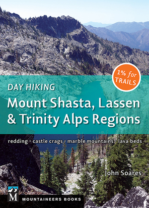
My recent book Day Hiking: Mount Shasta, Lassen & Trinity Alps Regions has the following 11 destinations, and all of them can be short backpacking trips:
- Canyon Creek Lakes
- Long Canyon to Deer Creek Pass
- Granite Lake
- Parker Meadow and Mumford Meadow
- Boulder Lakes
- Big Bear Lake
- PCT Southwest From Scott Mountain Summit
- East Boulder and Upper Boulder Lakes
- Fox Creek Lake
- Hidden Lake
- South Fork Lakes
- Trail Gulch and Long Gulch Lakes
Both books came out in 2018 and are available at major bookstores, many outdoor stores and visitor centers, and at online outlets like Amazon.com and Bookshop.org. I chose these trails for their scenic beauty, but also because the trails are in good shape and the forest roads leading to the trailheads are usually in good shape, even for passenger cars.
100 Classic Hikes: Northern California, fourth edition on Amazon
Day Hiking: Mount Shasta, Lassen & Trinity Alps Regions on Amazon


I noticed in the high sierra signage stipulating “this is an unmaintained trail.” Sure would be nice to see these in the Trinity Alps.
I agree, Jan. However, I think it’s a matter of resources again. It costs money to make a sign and then have someone put it up.
Some of the trails on the USFS Trinity Alps topo map are marked as unmaintained.
Try L Lake to Kalmia Lake and then do the traverse into Mirror Lake from Kalmia Pass. It is the wild frontier.
Thanks for sharing the info about getting a fire permit. I used it to get mine earlier this year, even though I almost never have a campfire.
FYI: usually by midsummer campfires are forbidden.
you seem to be the man in the know. Were planning a memorial day trip in the area. hoping to go to Granite lakes but if snow is a problem Canyon Lakes trip might be an alternative. What do you think my probabilities are for either trip. I am hoping to miss the crowds on such a early time but obviosly we need to have fairly snow free conditions, Any thoughts or other suggested trips would be appreciated. Its a 10 hour drive for us. darn but we have some fine areas here to.
No clue in early January, but typically both still have substantial snow on Memorial Day. Call the relevant ranger station a few days before you want to go to get the latest snow and trail conditions.
The Trinity Alps Road and Trail Reports have returned as of June 09, 2017. They can be accessed via the Shasta-Trinity National Forest website at https://www.fs.usda.gov/detailfull/stnf/home/?cid=stelprdb5157705
This is a great resource! I have spoke to the Weaverville ranger (Becky) to get trail conditions going to Papoose lake, Thompson Peak and Grizzly Lake but there hasn’t been a report thus far for this year-2018, if you hear anything from other backpackers I would like to have that information. I was also wondering about Bob’s Farm Trail.
If you have any info on any of these places I would greatly appreciate the input, I plan to be on this awesome adventure July 22…………
Papoose can be scary and desolate when alone. It is lost in time. The final scramble is almost low level mountain climbing. Watch for rattlers and prepare for thunderstorms in July. The view from Grey Rock Pass is Kalmia Lake on the ridge in the clouds. Epic.
kalmia lake last year 23 aug 14 two days no fish left money up there to fine
Do you have current info on trail through Stonewall pass and to Siligo Meadows, down Deer Creek and out through Morris Meadows?
I don’t, but I think there would be substantial snow at Stonewall pass and beyond.
John, thank you for continuing with updates to this page. I think that some of your readers would find my site helpful: KlamathMountainTrails.us . This has frequently updated reports of conditions of all trails in the Six Rivers National Forest portion of the Trinity Alps Wilderness–for the present limited to that area of coverage. Also KML files with accurate paths showing trail locations.
I live in Coffee Creek and have been hiking the Alps for over 60 years. I start pushing the snow back in Feb. and by the end of may can have up to 100 miles in. I feed the Weaverville FS road and trail reports on my walks. If people are looking for current info I can most likely have it. Also if you want now temp and snow for Big Flat, Shimmy Lake, Bonanza King or Scott Mt. at cdec.water.ca. these are 24/7 auto sites.
That’s a lot of hiking in the Alps! Thanks for being such a good resource.
I still cannot navigate my way up Coffee Creek Road without getting lost in mining claim signage of a stay away nature. Salmon Lake is the ticket out of Big Flat. Nobody goes there. You have to drop in from the ridge. Scary but worth it.