Hike the trail to Ruffey Lake and Meeks Meadow Lake for a day, or backpack in and camp overnight. Ruffey Lake and Meeks Meadow Lake lie just below Etna Mountain in Klamath National Forest, just north of the Russian Wilderness. Both are sweet little lakes, both quite different, and both with their own charm.

These are two of my favorite out-of-the-way lakes near the Russian Wilderness; do this hike and you may not see anybody else, even at the height of the summer hiking season. When it’s time for a new edition of my Day Hiking: Mount Shasta, Lassen & Trinity Alps Regions, this hike will definitely be included.
Ruffey Lake and Meeks Meadow Lake Trail Key Data
Distance: 6.4 miles roundtrip
Difficulty: Moderate
Type: Day hike or Overnight
Elevation gain: 1800 feet
High point: 6950 feet
Season: June to October
Contact: Klamath National Forest, Salmon/Scott River Ranger District
Maps: USFS Marble Mountain Wilderness and Russian Wilderness, USGS Etna
Etna Summit Trailhead GPS coordinates: N 41 23.698 W 122 59.654
Notes: dogs allowed; you’ll see evidence of past cattle grazing around Meeks Meadow Lake
Etna Summit Trailhead Directions
Drive CA Highway 3 to the Etna turnoff, which is 26.5 miles from the junction of CA Highway 3 and I-5 in Yreka and 12.7 miles from Callahan. Drive a half mile down Collier Way, turn right on Main Street, and then drive 10.5 curvy and paved miles on Sawyer’s Bar Road to Etna Summit (actually a saddle). Park in the large lot on the left.

Hiking the Pacific Crest Trail from Etna Summit
Find the Pacific Crest Trail in the back part of the parking area near a signboard. Go right and start a moderate climb south. The Etna Creek drainage that hold Sawyer’s Bar Road is down to the left. Views are magnificent, including the Scott Valley, Etna Mountain, and the heart of the granitic Russian Wilderness just a few miles away.
The route alternates between open slopes filled with summer wildflowers and the deep shade of Shasta red fir forest. Make sure you look behind you at the northerly vista of the Marble Mountains. Reach a fork with the Ruffey Lake Trail at 1.6 miles.
Ruffey Lake Trail
Head steeply uphill just 200 feet to a gap dominated by the visage of Etna Mountain. From here the Ruffey Lake Trail descends a series of switchbacks east through Shasta red fir forest to reach Ruffey Lake at 1.9 miles. Thick forest borders the lake on three sides, with a broad rock ledge on the north side where the glacier that carved the lake spilled downhill toward the lower Ruffey Lake. You’ll find a couple of places to camp near the west shore, and a level place or two on the rock ledge. Make sure you follow Leave No Trace principles because you’re very close to the water. If you have a fire, you must also have a campfire permit. Anglers can fish for eastern brook trout.

Camp for Free in California National Forests
 California’s national forests and BLM lands have thousands of miles of dirt roads with lots of spots for dispersed camping (boondocking). My book provides all the info you need to get started (but is not a guide to specific sites):
- Researching the best locations
- Finding the best camping spots
- Backcountry safety and ethics
- What to take
Buy it on Amazon
Buy it on Apple, Kobo, and Nook
Climbing Etna Mountain: Cross-Country Challenge
This Etna Mountain is in Klamath National Forest and Siskiyou County in California; don’t confuse it with Mount Etna in Sicily. Our Etna Mountain is granitic and geologically stable, whereas Mount Etna in Sicily is an active volcano.
I haven’t yet climbed Etna Mountain, but it’s definitely on my radar. I did talk with a guy who climbed it, plus I’ve eyeballed it many times.

The best route starts from the northeast cornet of Ruffey Lake. From here, make your way up and northeast, initially staying just to the right of the steep area. Stay near the ridge. Sometimes you’ll climb in the open, sometimes in forest, and sometimes you’ll have to plow through brush.
The final bit to the top involves some scrambling and is likely easier from the north side. You’ll have a 360-degree view of the Marble Mountains, the Scott Valley, the Cascades with Mount Shasta, plus the Eddy Range, the Russian Wilderness, and the Trinity Alps.
Meeks Meadow Lake from Ruffey Lake
From Ruffey Lake the trail heads easterly and descends slightly through open territory dotted with summer wildflowers. It then begins a southerly descent through forest, eventually bordering an attractive meadow before arriving in the Meeks Meadow Lake Basin. It’s lush green here, from the willows and alders in the meadow to the shimmering leaves of quaking aspen to the needles of the many pine and fir trees.
Reach a trail fork at 3.1 miles. A left quickly reaches a meadow with camping opportunities. The main trail goes right past more level places to pitch a tent to cross Meeks Meadow Creek right at the lake’s outlet. Cross to the far side and look for a rough path that goes west 200 yards to the south side of the lake. Here you can gaze at the shallow waters and the headwall on the west side, and take in the visage of Mount Etna.


My Youtube Video of Meeks Meadow Lake
From my Northern California Hiking Trails Youtube channel. (Great if you subscribe!)
From Meeks Meadow Lake to the Pacific Crest Trail: Trail Disappears, July 2020 Update
The trail continues south from the crossing of the outlet creek of Meeks Meadow Lake. I climbed about 1.5 miles to a point beyond the Smith Lake drainage and a few hundred yards beyond the meeting with a dirt road. The trail was easy enough to follow, although there were several downed trees. However, on an open fern-filled slope, the trail disappeared just after crossing a small seasonal stream. I tried hard to find it, but couldn’t. I wound up climbing cross-country up the steep slope to the Pacific Crest Trail.
Meeks Meadow Lake from the Pacific Crest Trail near Smith Lake: 2018 Attempt
The US Forest Service map of the Russian Wilderness shows a trail junction a few hundred yards south of Smith Lake. A trail leaves the Pacific Crest Trail and — on the map — initially runs northeast before swinging south and then north to arrive at Meeks Meadow Lake. I started on this trail on July 5, 2018. It was initially easy to follow, but quickly become covered with needles and duff. Either I lost it or it became very faint. I eventually decided to strike northeast cross-country down the granite talus jumble below Smith Lake. I recovered the trail about a half-mile from Meeks Meadow Lake and switchbacked my way to Meeks Meadow Lake on obvious trail.
Other Russian Wilderness Hiking Trails
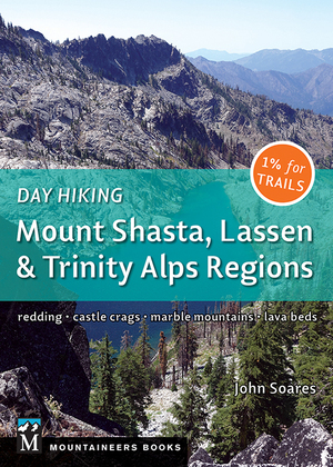
Want more Russian Wilderness hiking trails? Check out my guidebook Day Hiking: Mount Shasta, Lassen & Trinity Alps Regions. It includes trails to:
- Paynes Lake and Upper Albert Lake
- Duck Lakes: Big Duck Lake and Little Duck Lake
- Taylor Lake, Hogan Lake, and Big Blue Lake
- Russian Lake
Here on the blog I have full trail descriptions of:
- Sugar Lake Trail
- Ruffey Lake and Meeks Meadow Lake Trail
- Taylor Lake in the Russian Wilderness: Hiking, Camping, Fishing
Best Day Hiking Trails in Upper California
 My compact guidebook has the 125 best day hikes:
- Mount Shasta and nearby
- Lassen Volcanic National Park
- Trinity Alps and Marble Mountains
- Redding area
- Whiskeytown and Shasta Lakes
Includes trailhead directions and detailed maps and trail descriptions
Buy it: on Amazon | on Bookshop.org
Often available at bookstores and outdoor stores (call first!)
My Youtube Video of Etna Mountain and Ruffey Lake
Your Take
Have you been to Ruffey Lake or Meeks Meadow Lake? Thoughts? Questions?


Leave a Reply