Day hike or backpack the beautiful Whitney Butte Trail in Lava Beds National Monument to get away from the crowds and experience high-desert solitude. This article contains a detailed trail description and a trail map that give you everything you need to know to fully enjoy the Whitney Butte Trail.
Lava Beds National Monument hosts many hiking trails, some to its famous lava tube caves, others through the open high desert. The Whitney Butte Trail is a mix: it starts at Merrill Ice Cave before wandering through sage and juniper to Whitney Butte and Callahan Lava Flow. The hike features wildlife, open vistas of northeastern California, up-close views of volcanic land forms, and backpacking opportunities for the adventurous.

Lava Beds Hiking Trails in My Hiking Guidebook
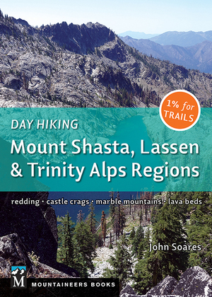
The description below of the Whitney Butte Trail is just one of 8 Lava Beds hikes in my new book Day Hiking: Mount Shasta, Lassen & Trinity Alps Regions. Here’s the complete list of trails in Lava Beds National Monument:
 87. Heppe Ice Cave
88. Big Nasty Trail
89. Symbol Bridge and Big Painted Cave
90. Schonchin Butte
91. Whitney Butte
92. Black Crater and Thomas-Wright Battlefield
93. Gillem Bluff
94. Captain Jack’s Stronghold
95. Discovery Marsh and Sheepy Ridge (in nearby Tule Lake National Wildlife Refuge)
And also see my blog post about exploring Boulevard Cave and Balcony Cave.
Lava Beds Whitney Butte Trail: Key Data
Length: 6.6 miles round-trip
Hiking time: 4 hours
High point: 5,010 feet
Total elevation gain: 500 feet
Difficulty: easy
Season: March to November; frequently snow-free in winter
Water: none; bring your own and plenty of it
Map: USGS Lava Beds National Monument, USGS Schonchin Butte, park brochure
Information: Lava Beds National Monument
Notes: Dogs prohibited. Before going into any cave, you must check with the entrance station or the Visitor Center. Toilet at trailhead. Entrance fee.
Trailhead GPS: N 41 43.685 W 121 32.972
Best Day Hiking Trails in Upper California
 My compact guidebook has the 125 best day hikes:
- Mount Shasta and nearby
- Lassen Volcanic National Park
- Trinity Alps and Marble Mountains
- Redding area
- Whiskeytown and Shasta Lakes
Includes trailhead directions and detailed maps and trail descriptions
Buy it: on Amazon | on Bookshop.org
Often available at bookstores and outdoor stores (call first!)
Trailhead Directions for Whitney Butte and Merrill Ice Cave
Drive Lava Beds National Monument Road 2.1 miles north of the Visitor Center (7.6 miles south of the Hill Road, Lava Beds National Monument Road junction). Turn west at the sign for Merrill Cave and go 0.8 mile to the parking area.

Hiking the Whitney Butte Trail

The path to Whitney Butte begins in a northwest direction, slowly descending through a landscape dotted with sagebrush, antelope bitterbrush, rabbitbrush, and mountain mahogany. Western juniper is by far the most common tree, but you’ll also spot a few ponderosa pines. Look north for views of the Devil’s Homestead Lava Flow, Gillem Bluff, Tule Lake, Mount Dome, and distant Mount McLoughlin in southern Oregon. To the east rises Schonchin Butte, which, like Whitney Butte, is a cinder cone.
The trail bends westward at 1.8 miles, allowing the first view of the broad flanks and high summit of Mount Shasta. Go left at a trail fork at 2.2 miles, continue west, and then eventually border the northern edge of Whitney Butte.
Whitney Butte and Callahan Lava Flow
After rounding Whitney Butte, the trail continues another 0.1 mile to end at the edge of the Callahan Lava Flow. This massive sheet of basalt covers many square miles and was extruded from Cinder Butte to the south around 1100 years ago. Note that lichens and a few plants have begun the slow process of colonizing at the edge of the flow.
The Top 100 Day Hikes and Backpacking Trips in Northern California
 The all-color fourth edition features the best trails:
- Northern Sierra Nevada
- Lassen and Mount Shasta areas
- Trinity Alps and Marble Mountains
- Redwood Coast
- Wine Country and Bay Area
Includes trailhead directions and detailed maps and trail descriptions
Buy it: on Amazon | on Bookshop.org
Often available at Barnes & Noble, REI, and other quality bookstores and outdoor stores (call first!)
To reach the summit of Whitney Butte, retrace your steps to a ponderosa pine growing where the trail bends and where you had your first good views of the Callahan Lava Flow on the way in. From here, pick your own route to the top of the cinder cone, where excellent views in all directions await. Return the way you came.
Backpacking in Lava Beds National Monument
The Whitney Butte Trail is one of three trails in Lava Beds National Monument that are suitable for backpacking. The other two are the Three Sisters Trail and the Lyons Trail.
If you’re a backpacker, remember the following: Bring all water with you (at least 1 gallon per person per day); fires are always prohibited, and even gas stoves may be prohibited during times of high fire danger; camp at least a quarter mile from the trailhead and public roads (there are no developed sites, but you’ll find numerous flat areas).
Exploring Merrill Ice Cave
Merrill Ice Cave, reached by a short paved trail from the parking lot, ranks as one of the most spectacular in Lava Beds National Monument. From the trail’s end, you’ll descend a 15-foot stairway, travel through the cave, and then descend a 17-foot ladder to the cave’s lower chamber.


If you enter Merrill Ice Cave, remember the following: Tell someone where you’re going; don’t go alone; wear a hard hat, sturdy shoes, a jacket, and pants; carry at least three sources of light; don’t damage rock formations; where trails exist, stay on them; leave a cave quietly if you encounter bats; check with the entrance station or the Visitor Center before exploring any cave in Lava Beds National Monument.
Your Take on the Whitney Butte Trail
Have you done the hike? What did you think? Questions? Let us know in the comments below.


Leave a Reply