Northern California is a great place for a spring 2026 backpacking trip! Here are the best low/middle elevation trails in the Bay Area, Northern Sierra Nevada, Lassen National Forest, Klamath Mountains, redwoods, and North Coast. You can hike many of them year-round, even in winter.

Tired of Winter, Ready to Backpack This Spring, 2026?
Wherever you live in Northern California or travel in Northern California, this post shares the best backpacking trails of the North State, updated for spring 2026. Here you’ll find easy overnight backpacks and a few longer multi-day treks, all usually below snowline in springtime. Of course, you can hike most of these year-round, including fall/autumn and winter.

Northern California Spring Backpacking Trip = Low/Middle Elevation Trails That Are Snow-Free
Some of the backpacking trips here are right along the coast, while others range as high as 5000 feet. The defining factor is little or no snow on the trail. (Of course, if you’re willing to hike on snow, you have many more options at higher elevations, but I’m not covering those here.)
Climate Change Can Mean Backpacking Some Higher-Elevation Trails in Spring
Climate change (global warming) in Northern California (and many other places) means that there is usually overall less snow (because more precipitation falls as rain, especially in later spring) and it melts out earlier (because it’s warmer).
As a result, in some years you can backpack trails into the high country even in late April and May, especially if the trailhead is at middle elevation.
I focus here on low and middle elevation backpacking trails, but keep this in mind, especially if it’s later in spring and the snow’s been melting fast.
Always Call First to Make Sure the Trail Is Open and Accessible
Check with the governing agency to make sure that the road to the trailhead is open and passable for your vehicle, and that the trail itself is open and (mostly) snow-free. It’s common for national forests to close many roads from late fall to early summer. You don’t want to pack up and do a long drive and not be able to reach the trailhead.
Wildfires Can Result in Closed Trails
Wildfires often result in trail closures or other restrictions, sometimes for months or years. Check the government agency website and always call ahead to make sure you can do the hike.
And You May Need a Backpacking/Camping Permit…
In some cases, like national and state parks in the San Francisco Bay Area, you may need to get one of a limited number of camping permits first, often from recreation.gov for federal lands. Call ahead! And, if you can, plan your backpacking trip for mid-week; there’s often a long wait to get camping permits for the weekend. Also check to see if you need a parking permit.
And remember, backpackers need a California campfire permit!
Always Check the Weather First and Be Prepared
Get a reliable weather forecast for the exact area you want to hike. I prefer the National Weather Service, which creates forecasts for specific spots anywhere in Northern California and beyond. Be prepared for any type of weather and for low temps.
Many of These Backpacking Trips Are in My Northern California Hiking Guidebooks

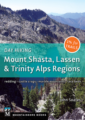
Two of my hiking guidebooks contain a lot of routes suitable for spring backpacking: Day Hiking: Mount Shasta, Lassen & Trinity Alps Regions and 100 Classic Hikes: Northern California, fourth edition (both published by Mountaineers Books).
Where relevant, I indicate a Day Hiking trail with (DH XX), where XX is the hike number, and a 100 Hikes trail with (100 XX), where XX is the hike number.
And Some of These Hikes I Haven’t Done
Or haven’t done in a long, long time. This means I don’t know the specifics of the trip and you need to make sure you check with the responsible agency and other sources, including websites and other guidebooks, to make sure you have all the relevant info to determine when, where, and if you should go.
Note: in most instances I just list a park or region in Northern California that is a great place for spring backpacking, but I don’t give the specifics of exactly where to hike. Many of the parks/regions have multiple backpacking options. Again, you’ll need to do further research online, in other hiking guidebooks, and by contacting the governing agency.
I Provide Links to Posts Here on the Northern California Hiking Trails Blog
…for some of the trails. In nearly every case, you’ll find a detailed trail description, trailhead directions, trailhead GPS coordinates, a trail map, and photos.
For the other trails, the website of the governing agency usually has detailed information on trails open to backpackers, and also on backcountry camping and primitive campsites, and you can nearly always download a map. There are numerous other websites with varying degrees of information about the trails listed here, some of it quite good, some of it superficial, and some of it dated. Search online, and pay attention to the overall quality of the websites you consult.
Northern Sierra Nevada Spring Backpacking Trails
The low-elevation foothills of the Northern Sierra Nevada, along with the middle elevations, have several excellent trails for spring backpacking. Check out these Northern Sierra Nevada treks:
- Preston Flat Trail. Stanislaus National Forest, Groveland Ranger District
- Hetch Hetchy Trail to Rancheria Falls. Yosemite National Park
- South Yuba River Trail. Tahoe National Forest: Yuba River Ranger District; Malakoff Diggins State Park
- American River Trail, North Fork of the American River. Tahoe National Forest: Foresthill Ranger Station
- Last Chance Trail. Tahoe National Forest: American River Ranger District
- Pioneer Trail. Tahoe National Forest, Yuba River Ranger District
- Feather Falls, Plumas National Forest: Feather River Ranger Station (100: 25)
Lassen National Forest and Lava Beds National Monument Spring Backpacking Trails
Lassen National Forest, Lava Beds National Monument, and the bordering areas have many options for spring backpacking trips.
My book Day Hiking: Mount Shasta, Lassen & Trinity Alps Regions covers some of the Lassen National Forest trails below, and many trails nearby that only allow day hiking (in case you want to set up a central campsite as a base for day hiking).
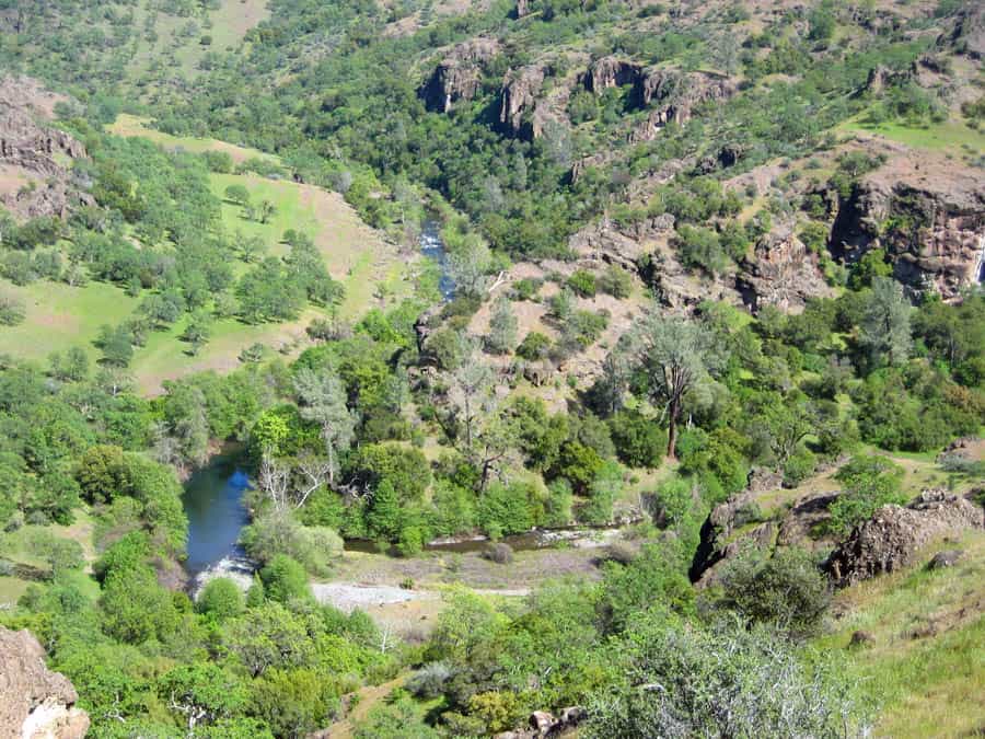
- Deer Creek near Highway 32. Lassen National Forest: Almanor Ranger Station (DH 121; 100 26)
- Yana Trail and Massacre Flat, Sacramento River Bend Area. Bureau of Land Management Redding Field Office (DH 3)
- Upper Mill Creek Trail near Ishi Wilderness. Lassen National Forest: Almanor Ranger Station. This area is within the perimeter of the 2024 Park Fire and suffered substantial burning.
- Lower Mill Creek Trail, Ishi Wilderness. Lassen National Forest: Almanor Ranger Station (DH 119; 100 27). This area is within the perimeter of the 2024 Park Fire and suffered substantial burning.
- Antelope Creek. Lassen National Forest: Almanor Ranger Station. This area is within the perimeter of the 2024 Park Fire and suffered substantial burning.
- Bizz Johnson National Recreation Trail. Bureau of Land Management Eagle Lake Field Office
- Ahjumawi Lava Springs State Park
- Pacific Crest Trail, Hat Creek Rim Trailhead to Forest Road 22. Lassen National Forest: Hat Creek Ranger Station
- Pacific Crest Trail, Forest Road 22 along Hat Creek Rim to Baum Lake. Lassen National Forest: Hat Creek Ranger Station
- Whitney Butte Trail. Lava Beds National Monument (DH 91; 100 41)
- Lyons Trail. Lava Beds National Monument
- Three Sisters Trail. Lava Beds National Monument

Klamath Mountains Spring Backpacking Trails
The Klamath Mountains include the Trinity Alps Wilderness, the Marble Mountain Wilderness, the Russian Wilderness, and the mountains west of Mount Shasta, plus much more. Most of the trails and trailheads are at high elevation and not suitable for spring backpacking, but a few trails do run at middle elevations.
- Pacific Crest Trail, Castle Crags State Park and Castle Crags Wilderness. Shasta-Trinity National Forest: Mount Shasta Ranger Station. (And consider camping and then doing day hikes in Castle Crags State Park)
- Kelsey National Recreation Trail, Maple Falls on Kelsey Creek near Marble Mountain Wilderness. Klamath National Forest: Salmon/Scott Ranger District (DH 85)
Best Day Hiking Trails in Upper California
 My compact guidebook has the 125 best day hikes:
- Mount Shasta and nearby
- Lassen Volcanic National Park
- Trinity Alps and Marble Mountains
- Redding area
- Whiskeytown and Shasta Lakes
Includes trailhead directions and detailed maps and trail descriptions
Buy it: on Amazon | on Bookshop.org
Often available at bookstores and outdoor stores (call first!)
Trinity Alps Wilderness and Nearby
Many Trinity Alps Wilderness trailheads accessible from Highway 3 are at fairly low elevation and are often snow-free in by late spring. The trails leaving from these trailheads can also be clear of snow for several miles, and they typically travel through old-growth forest and near beautiful streams, with views of rocky peaks high above.
Be sure to check with the Weaverville Ranger Station about both driving access to the trailhead and the approximate snow-line elevation before you plan your trip.

- Canyon Creek Lakes. Shasta-Trinity National Forest: Weaverville Ranger Station (DH 67; 100 61)
- Stuart Fork Trail to Morris Meadows. Shasta-Trinity National Forest: Weaverville Ranger Station. This area was partially burned during the 2023 Deep Fire..
- Long Canyon. Shasta-Trinity National Forest: Weaverville Ranger Station (DH 68; 100 60)
- Swift Creek Trail to Parker Meadow and Mumford Meadow. Shasta-Trinity National Forest: Weaverville Ranger Station (DH 70; 100 58)
- Coffee Creek Road to Big Flat Campground. Several trails leave from this road, including the Tri-Forest-Peak Trail. Shasta-Trinity National Forest: Weaverville Ranger Station. Some of the trails were burned over during the 2021 wildfires.
Explore the Wild and Rugged Trinity Alps With This New Map!

The alpine lakes and jagged peaks of the Trinity Alps Wilderness rival the scenery of the High Sierra, without the crowds. This new highly detailed map is perfect for your next backpacking trip or day hike:
- Canyon Creek Lakes, Caribou Lake, and all the main destinations
- Trails with more solitude in more remote parts of the wilderness
- Obtaining a wilderness permit
- Boundaries of recent wildfires
Buy it online from: Green Trails Maps | Amazon
Often available at outdoor stores and bookstores (call first!)
Redwoods and North Coast Spring Backpacking Trails
The Lost Coast, which is mostly in Sinkyone Wilderness State Park and King Range National Conservation Area, offers the most extensive and rugged backpacking experience in this region, and spring is a good time to do it (weather permitting). Shorter backpacking options await in Redwood National and State Parks along Coastal Trail sections near Highway 101, and elsewhere along the coast and in the redwoods.
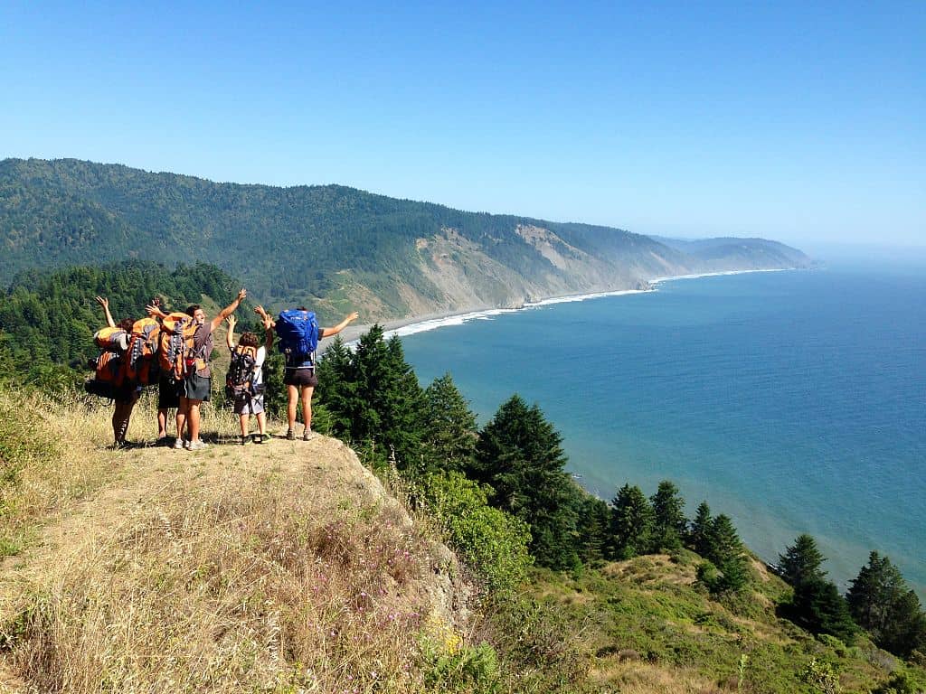
- Lost Coast. Sinkyone Wilderness State Park, King Range National Conservation Area
- Grasshopper Summit, Humboldt Redwoods State Park.
- Coastal Trail, Gold Bluffs Beach to Flint Ridge Section. Prairie Creek Redwoods State Park and Redwood National Park, Redwood National and State Parks
- Little Bald Hills Trail. Jedediah Smith Redwoods State Park/Redwood National Park in Redwood National and State Parks. (100: 64)
- South Kelsey Trail. Smith River National Recreation Area
- Summit Valley Trail. Smith River National Recreation Area
The Top 100 Day Hikes and Backpacking Trips in Northern California
 The all-color fourth edition features the best trails in:
- Northern Sierra Nevada
- Lassen and Mount Shasta areas
- Trinity Alps and Marble Mountains
- Redwood Coast
- Wine Country and Bay Area
Includes trailhead directions and detailed maps and trail descriptions
Buy it: on Amazon | on Bookshop.org
Often available at Barnes & Noble, REI, and other quality bookstores and outdoor stores (call first!)
Bay Area Spring Backpacking Trails
The San Francisco Bay Area contains many state and regional parks with networks of hiking trails and backcountry campsites, which makes this an excellent area for backpacking in the spring months (and year-round). Be forewarned: many of these Bay Area parks have strict limits on the number of backpacking permits they allow, and spring is a very popular time.
- Skyline to the Sea Trail. Big Basin Redwoods State Park (100: 94 and 95) Closed indefinitely due to fire damage
- Castle Rock State Park (100: 96)
- Butano State Park (100: 93) Partially closed due to fire damage
- Pescadero Creek Park, San Mateo County
- Sam McDonald Park, San Mateo County
- Portola Redwoods State Park
- Henry Coe State Park
- Morgan Territory Regional Preserve
- Ohlone Wilderness Regional Preserve
- Sunol Wilderness Regional Preserve
- Black Diamond Mines Regional Preserve
- Monte Bello Open Space Preserve
- Angel Island State Park (a great San Francisco area hiking trail)
- Gerbode Valley. Marin Headlands in Golden Gate National Recreation Area
- Coast Trail to Glen Camp, Wildcat Camp, and Wildcat Beach. Point Reyes National Seashore (100: 83)
- Mount Wittenberg and Sky Camp. Point Reyes National Seashore
- Austin Creek State Recreation Area (100: 77) Currently closed due to fire damage
- Hood Mountain Regional Park
- Berryessa Peak
- Cache Creek Wilderness. Bureau of Land Management Ukiah Field Office
Big Sur and Ventana Wilderness Spring Backpacking Trails
Big Sur and the Ventana Wilderness has some of the most dramatic and undeveloped coastline of the entire Pacific Coast of the United States. Its proximity to both the San Francisco Bay Area and Southern California makes it a popular spot for all types of visitors, including hikers.
Note: the Big Sur area has been heavily impacted by recent wildfires. Be sure to check first that these trails are open.
- Skinner Ridge Trail. Los Padres National Forest, Monterey Ranger District
- Sykes Hot Springs. Los Padres National Forest, Monterey Ranger District
- Pine Valley. Los Padres National Forest, Monterey Ranger District
Camp for Free in California National Forests
 California’s national forests and BLM lands have thousands of miles of dirt roads with lots of spots for dispersed camping (boondocking). My book provides all the info you need to get started (but is not a guide to specific sites):
- Researching the best locations
- Finding the best camping spots
- Backcountry safety and ethics
- What to take
Buy it on Amazon
Buy it on Apple, Kobo, and Nook
Please Link to this Post and Share It…
My goal is to get as many people out on the trails as possible. Please share the link on your social media channels and link to it from your website.
Northern California Spring Backpacking Trips: Thoughts and Suggestions?
Other spring backpacking trips in Northern California I should have included? Anything specific to know about the hiking trails I mentioned? Share in the comments below…



Great info and well researched! Thank you for sharing.
Thanks Al! The research was a lot of fun!
Everywhere I am thinking of going next week is on here! You have trained me well.
I’m very glad to hear that!
We started our backpacking trip on Snow Mountain (Mendocino National Forest) near the bottom, at the Deafy Glade Trail. It’s a tough, steep climb.
Careful with snow, if you go up high enough.
Hi John,
I just ordered your book from Amazon, but wanted to ask your recommendation for a first time overnight backpacking trip with my daughter. I have been on several trip in Northern California, but this would be her first and wanted to make sure it’s a pleasurable experience. She 21 and runs and hikes on a regular bases. Also, I appreciated your story on hiking during the Coronavirus pandemic.
Thanks for ordering a book. Much appreciated!
Can you tell me roughly when you want to go, and in what area?
We would love to go in a month or two once things start opening back up.
We live in the Auburn, CA and willing to go up to 100 miles. The coast sounds appealing because of the cooler weather.
Scott, some good nearby options for June into July near you would be:
Sand Ridge and the Five Lakes Basin (Hike 20 in my 100 Classic Hikes, 4e)
Crooked Lakes Trail to Penner Lake (Hike 21, same book)
You could combine them into a 1-3 night trip. Try to go mid-week so there’s fewer people.
Coast hikes are quite a drive and would have a lot of people.
Are the Bay Area trails you listed actually open this spring after the wildfires? The first 7 on your list were badly damaged last autumn.
Several are still closed as of this moment, and it’s unclear when they’ll open. I made the post more explicit about the impact of wildfires and the importance of calling the government agency first to make sure trails are open.
I am a college student with a lot of backpacking experience. This may when school gets out, I would really like to go on a 5 or more day backpacking trip in the Sierra Nevada or any mountains in California without too much snow. Most of the typical rigorous sierra backpacking found on the internet are not really possible in may because there is too much snow. Does anyone know any California spots that are remote where the isn’t too much snow in May? I have glacier experience and some snow camping experience but would prefer to not have to be in that much snow where I would need snow shoes or skies.
What would be some good hikes to do in spring with little kids, 5 and 7? 1 nighter backpacking trip without to much elevation change.
Felicia, I think you can best get an answer to this question by posting it to relevant Facebook hiking groups for Northern California. Be sure to give the geographic area you are most interested in.